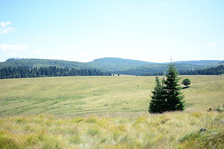
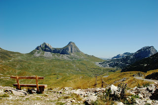
Pokazywanie postów oznaczonych etykietą mountains. Pokaż wszystkie posty

środa, 8 lipca 2015

Through Bârsana to the Rodna Mountains National Park

DAY 5
Romania/Maramures

il. 1 Time to go


Today we have a long way to Rodna Mountains and the temperature does not spare us. The thermometer shows nearly 40 Celsius degrees .

Dzisiaj czeka nas długa droga w Góry Rodniańskie, a temperatura nas nie oszczędza. Termometr wskazuje niemal 40 stopni Celsjusza.


il. 2-3 The views from the road


il. 4-5 Bârsana monastery complex


On the way we visit the picturesque monastery in Bârsana. And then we head directly toward the national park: Parcul Naţional Muntii Rodnei, which is located on the border Maramures and Bystrica.

Na trasie zwiedzamy znany części z nas żeński zespół klasztorny w Bârsanie - wybudowany stosunkowo niedawno, lecz utrzymany w tradycyjnym stylu i bardzo malowniczy. Potem kierujemy się już bezpośrednio w stronę parku narodowego: Parcul Naţional Munţii Rodnei, który mieści się na granicy Maramureszu i Bystrzycy.


il. 6 Parcul Naţional Muntii Rodnei

wtorek, 7 lipca 2015

A nymph, salt water and a goat cheese

DAY 4
Romania/Maramures


il. 1 A nymph in the stream


During a morning bath in the stream we stumbled upon the Romanian nymph (il. 1), which turned out to be not such timid and not such Romanian.
We follow the signs to Ocna Şugatag, where waiting for us brine pools (il. 2). The water displacement is so huge that you can safely sit cross-legged with head and shoulders above the water's surface.

Podczas porannej kąpieli w strumieniu natknęliśmy się na rumuńską nimfę (il. 3), która okazała się nie taka znowu płocha i nieszczególnie rumuńska.
Kierujemy się do Ocna Şugatag, gdzie czekają na nas baseny solankowe (il. 3). Wyporność w nich jest tak duża, że spokojnie można siedzieć po turecku, a głowę i ramiona i tak ma się powyżej tafli wody. Stan zasolenia niemal jak w morzu martwym.


il. 2 Road through the mountains and forests
il. 3 Parachuting in the water


After a bath and the hottest time of the day, we go to search the regional cuisine. A definite hit turn out to be sarmale - romanian cabbage rolls.

Zaznawszy kąpieli i przeczekawszy najgorętszą porę dnia, kierujemy się na poszukiwanie regionalnej kuchni. Zdecydowanym hitem okazują się sarmale - w rumuńskim wydaniu gołąbki.


il. 4 Buying a goat cheese
il. 5 A cute baby goat


We spend rest of the day and the night in a lovely glade at the murmuring stream.
Resztę dnia i noc spędzamy na uroczej polanie przy szemrzącym potoku.

il. 6 Fields
il. 7 Find a dog!


poniedziałek, 6 lipca 2015

The mountains and a regional cuisine

DAY 3
Romania/Maramures


Il. 1 Planning a route


The original plan was to set up another basecamp close to the lake, but for the sake of the summer season, the one shore of the lake was occupied by holidaymakers. We are trying to attack the other, deserted shore, but all forest roads lead us astray and in the end we give up.


Pierwotny plan był taki, aby kolejną bazę założyć nad jeziorem, jednak przez wzgląd na porę wakacyjną, lepiej zagospodarowany brzeg wody okazał się być oblegany przez letników. Próbujemy dokonać ataku na drugi, wyludniony, brzeg, jednak wszystkie leśne drogi prowadzą nas na manowce i w końcu dajemy za wygraną.

Il. 2-4 Passed views


Il. 5 Brook in the valley


We stop for the regional soup in Baia Sprie. In menu is ciorba de burta (tripe soup), ciorba de teranesca (peasant) and ciorba de beans (with string beans). After the meal, through the area of disused gold mine, we enter the mountains (il. 2-4).

For a night we stop in a picturesque valley on the way to Băiuţ (il. 5-6).

Zatrzymujemy się w znanej już nam wcześniej knajpce w Baia Sprie na regionalną zupę. Do wyboru ciorba de burta (flaki), ciorba de teranesca (chłopska) i ciorba de fasola (z fasolą szparagową), a następnie przez teren nieczynnej już kopalni złota, wjeżdżamy w góry (il. 2-4).

Biwak zakładamy w malowniczej dolinie na trasie do Băiuţ (il. 5-6).


Il. 6 Unpacking cars


niedziela, 5 lipca 2015

The lazy Sunday in Muntii Lapus

DAY 2
Romania/Maramures


Il. 1 Morning


Il. 2 Washing the dishes after breakfast


The bright sun rises heralding a lazy day (il. 1). A lot of local people from the surrounding villages came to spend weekend in the nature. Part of our team want to spent Sunday actively and part more static. At a time when we're going for a walk to explore the area (il. 3-5), the rest of the company rests in the camp sipping Hungarian and Romanian drinks.

Wstaje leniwy dzień (il. 1). Przyjechało dużo miejscowych z okolicznych wiosek by spędzić niedzielę na łonie natury. W naszej drużynie następuje podział na wypoczywających aktywnie i bardziej statycznie. W czasie, gdy wybieramy się na spacer, aby wyeksplorować okolicę  (il. 3-5), reszta towarzystwa wypoczywa w obozowisku popijając węgierskie i rumuńskie trunki. Z oddali słychać jak dzwonią niespiesznie poganiane przez pasterzy stada owiec. 


Il. 3-5 Walk around


The temperature has exceeded 30 degrees, so we're going to immerse ourselves in the cool water of a lake Firiza (il. 6-7). After returning to camp, we light the fire and prepare the mititei and Pieczonki. Rest of the evening we spent around the campfire (il. 8).

Temperatura przekroczyła 30 stopni, więc jedziemy zanurzyć się w chłodnej wodzie jeziora Firiza (il. 6-7). Po powrocie rozpalamy ognisko i przyrządzamy mici oraz pieczonki i do wieczora spędzamy czas przy ognisku (il. 8).


Il. 6-7 Lake Firiza


Il. 8 Waiting for 'pieczonki'.


piątek, 29 sierpnia 2014

Picturesque views and car trouble

DAY 14, Montenegro/Serbia
Romania-Bulgaria-Greece-Macedonia-Albania-Montenegro with Aventura Maramures


il. 1-2 Way to the Durmitor National Park


We are approaching the end of the journey. We drive through the mountains (il. 3-7) witch dazzle with its beauty. Unfortunately, we do not have time to ride the picturesque Valley of Tara river (Europe's deepest canyon reaching up to 1300 m depth!), but we stop for a while on the 360 m lenght concrete bridge Đurđevića, which is here considerable tourist attraction. The bridge was built in 1937-1940. You can see it in the movie "Force 10 from Navarone" filmed in 1978.

Zbliżamy się do końca wyprawy. Przebijamy się przez góry (il.3-7), które olśniewają swoją urodą. Niestety na przejażdżkę niezwykle malowniczą Doliną rzeki Tary nie mamy już czasu (najgłębszy w Europie kanion osiągający do 1300 m głębokości!), ale zatrzymujemy się chociaż na betonowym moście Đurđevića o dł. 360 m, który stanowi niemałą atrakcję turystyczną. Most wybudowano w latach 1937-1940 i zobaczyć go także można w filmie „Komandosi z Navarony” z 1978 roku.


il. 3-7 Durmitor National Park


After crossing the Serbian border B. reminded of the obligation to have a document certifying our stay in Montenegro, which we should get from the police office and which is apparently necessary to cross the border. But somehow we managed without it.

Już po przejechaniu granicy Czarnogórsko-Serbskiej przypomina nam się o obowiązku wyrobienia sobie dokumentu zaświadczającego o pobycie w Czarnogórze, który wyrabia się na dowolnym posterunku policji, a jest ponoć konieczny do przekroczenia granicy. Nam się jednak jakoś udało bez niego.


Our problems with the alternator increase. We are looking for overnight a camping site or a hotel where we could charge it, but we can't find anything. Already dusk and our lights in the car go out. Power remnants we turn toward the village buildings and pitched tents on someone's meadow with the intention to look for help in the morning.

Nasze problemy z alternatorem pogłębiają się. Szukamy na nocleg pola namiotowego lub hotelu, gdzie moglibyśmy go naładować, ale na złość na naszej trasie nie możemy nic znaleźć. Już zmierzcha a nam gasną światła. Resztkami mocy skręcamy w stronę zabudowań i rozbijamy namioty na czyjejś łące z zamiarem poszukania pomocy o poranku.


il. 8 Tara River


il. 9-10 Đurđevića Tara Bridge


środa, 27 sierpnia 2014

Lake Skadar in the main role

DAY 12, PART 2/2: Montenegro
Romania-Bulgaria-Greece-Macedonia-Albania-Montenegro with Aventura Maramures


Il. 1 village by the lake Skadar


Il. 2 The lost land


Montenegro welcomes us with unripe pomegranates (il. 3), beautiful towns and extremely attractive cows (il. 4). After a small adventures we find the path that leads us along the shores of Lake Skadar. On the way we give cunning crone two cigarettes (rather than four, which she pretentious demands of us), and we find the tree with hairy pears - which, to be honest, don't taste good.

Czarnogóra wita nas niedojrzałymi granatami (il. 3), pięknymi miasteczkami oraz nad wyraz atrakcyjnymi krowami (il. 4). Po małych perypetiach odnajdujemy drogę, która prowadzi nas wzdłuż brzegu jeziora Szkoderskiego. Na trasie obdarowujemy chytrą babę dwoma papierosami (nie zaś czterema, których pretensjonalnie od nas żąda) i znajdujemy drzewo z włochatymi gruszkami, które mówiąc szczerze, nie smakują najlepiej.


Il. 3 In the Polish language grenade and pomegranate is the same word.
Illustration by Zuzanna Wilczynska


Il. 4 Why did the cow cross the road? 
- To get to the udder side. Ha ha ha...
More jokes about cows: jokes4us
Illustration by Zuzanna Wilczynska


After a lot of pictures and a stunning views, faster than we want to, the evening comes. Our car battery shows signs of a lack of charging. We arrive at the village of Virpazar and from there we go by over 4 km long tunnel (Sozina) to the coast. In Sutomore, on our map is marked a campsite, but it turns out to be a false trail. We head towards the Bar, which is a larger town. We hope that there we will find a camping.

Dużo zdjęć i dużo zachwycających widoków za nami. Szybciej niż byśmy sobie tego życzyli nastaje wieczór, a nasz akumulator wykazuje oznaki braku ładowania. Dojeżdżamy do miejscowości Virpazar i stamtąd kierujemy się ponad 4 km długości tunelem Sozina na wybrzeże. W Sutomore na naszej mapie jest zaznaczone pole namiotowe, ale okazuje się to fałszywym śladem, więc kierujemy się w stronę większego miasta o zacnej nazwie Bar, w nadziei, że tam uda nam się znaleźć miejsce kempingowe.


Il. 5 The islands on Lake Skadar


Il. 6 Road along the lake is very winding and dangerous, unfortunately not all travelers are fortunate enough to cross it safely...


Il. 7 Although the shore of the lake looks very tempting from the distance, we can't find any access for swimming. In Montenegro there is no designated beaches near to Skadar lake, in Albania there is only a few.


It's after sunset, but our car is flooded by a glow of light instead of the dark. Crowds of people on the streets, bustling, fun, stores open 24 hours. We feel almost like in Las Vegas. The event is in full swing, but we can't find the campsite. We locate tourist information where a nice lady directs us to Čanj. And rightly so! Because campsite turns out to be extensive and colorful like in a hippie commune. Also the password for WiFi: Love4all fits like a glove. Fortunately accommodating countrymen undertake recharge our battery. We know now, that the alternator is not charging while driving. Finally we can take a warm shower and go sleep.

Jest już po zachodzie słońca, a nasz samochód miast ciemności zalewa blask świateł. Tłumy ludzi na ulicach, gwar, zabawa, sklepy czynne 24h. Czujemy się niczym w Las Vegas. Impreza trwa w najlepsze, ale kempingu brak. Namierzamy zamykający się właśnie punkt informacji turystycznej skąd miła Pani kieruje nas do Čanj. I słusznie! Bo pole namiotowe okazuje się rozległe i kolorowe rodem z jakiejś hipisowskiej komuny, do której hasło do WiFi: Love4all pasuje jak ulał. Na szczęście uczynni rodacy zobowiązują się naładować nasz akumulator, który jak już wiemy, na skutek awarii alternatora, się nie ładuje podczas jazdy. Nareszcie czeka nas ciepły prysznic i upragniony sen.


wtorek, 26 sierpnia 2014

The city of a thousand windows

DAY 11, PART: 1/2: Albania
Romania-Bulgaria-Greece-Macedonia-Albania-Montenegro with Aventura Maramures

Il. 1 Sunrise!


Finally we get on the right road (partially covered with asphalt!) to Berat - the city of a thousand windows (il. 2). Why a thousand? There used to be much less, and now, as in any burgeoning city the number of windows is still growing. Situated on a steep slope below the citadel, the houses of the old town (placed on UNESCO list), one over the other, give the impression as looking at traveler (especially wen you stand on the opposite bank of the river) by its bustling eyes / windows. By day, reflections of the sun are dancing on glazing, at dusk begun the game of lights inside houses lights.

Przebijamy się w końcu na właściwą drogę (miejscami asfaltową!) prowadzącą do Beratu - miasta tysiąca okien (il. 2). Dlaczego tysiąca? Niegdyś było ich znacznie mniej, a obecnie, jak w każdym rozrastającym się mieście wciąż ich przybywa. Usytuowane na stromym zboczu poniżej cytadeli, domy starego miasta (wpisane na listę UNESCO), wyglądające jeden ponad drugim, sprawiają wrażenie jakby patrzyły na podróżnego (szczególnie, gdy stoi się na przeciwległym brzegu rzeki) swymi ruchliwymi oczami/oknami. Za dnia po wprawionych w nie szybach tańczą refleksy odbiającego sie słońca, po zmierzchu rozpoczyna się gra zapalanych we wnętrzach domów świateł.

Il. 2 The thousand windows - eyes of Berat haouses


The first mention of this fascinating city already appear in the sixth century BC. Initially, it was a small settlement, later transformed into a fortress (Citadel built there by the Illyrian tribe in the fourth century BC, in the second century BC it was took over, strengthened and expanded by the Romans), and finally into a city with a turbulent history. The original building has survived even though the authorities of the lands has changing many times. For a time, it was ruled by Bulgarians, who called it Beligrad (White City), later it was take over by the ruler of Epirus, then the kingdom of Serbia, after that it was the capital of the Albanian principalities Muzaka family, passed through the hands of the Turks (Arnavud Belgrade - Albanian Belgrade) to come back again in the possession of the Albanians.

Pierwsze wzmianki o tym fascynującym mieście pojawiają się już w VI w p.n.e. Początkowo jest to niewielka osada, przekształcona później w twierdzę (Cytadelę zbudowało tam Iliryjskie plemię Dasaretów w IV w p.n.e, a w II w p.n.e. przejęli, umocnili i rozbudowali ją Rzymianie), a następnie w miasto o burzliwych losach. Oryginalna zabudowa przetrwała mimo, że zmieniali się władcy ziem, na których zostało wzniesione. Przez jakiś czas władali nim Bułgarzy zwąc je Beligradem (Białym Miastem), później przejął je władca Epiru, następnie królestwo Serbii, zostało stolicą albańskiego księstwa rodu Muzaka, przeszło przez ręce Turków (Arnavud Belgrad – Belgrad Albański), by znów wrócić w posiadanie Albańczyków.


Il. 3-4 The citadel


Meanwhile, we climbed the citadel, an area which is till today inhabited. From a top we see a great view of the city and... two giants! And here is a story:
A long time ago, in what is now Albania, there lived two brothers giants: Tomorri and Shpirag. They lived together in unison, until it turned out that they both fell in love with the same girl. The dispute over her, they decided to settle by duel. Unfortunately is ended tragicaly for all three. The fight was long, bloody and balanced. After every blow, giants legs sank deeper and deeper into the earth. In the end, every of them received so many wound, that the spirit of the two bodies had fled. Desperate girl unable to control her sadness, sat between them crying until her tears formed a river (Osum), separating the two brothers bodies. However, it hasn't soothe her grief, and she died of exhaustion. Girls corpse has turned to stone creating a hill-foundation for the citadel, while the Tomorii (il. 5) and Shpirag (il. 6) bodies turned into great mountains surrounding Berat city.

My tymczasem wspięliśmy się na cytadelę, na obszarze której po dziś dzień mieści się zamieszkała część miasta. Rozpościera się stąd wspaniała panorama na miasto i... dwa olbrzymy! A było to tak:
Dawno, dawno temu, na obszarze dzisiejszej Albanii, żyło dwóch braci olbrzymów: Tomorri i Shpirag. Żyli ze sobą w zgodzie, do czasu, gdy okazało się, iż obaj pokochali tę samą dziewczynę. Spór o nią postanowili rozstrzygnąć poprzez pojedynek, które dla całej trójki zakończył się nieszczęśliwie. Walka była długa, krwawa i wyrównana. Po otrzymanym ciosie, nogi olbrzymów grzęzły coraz głębiej w ziemi. W końcu każdy z nich otrzymał tyle ran, że duch z obydwu ciał uleciał. Zrozpaczona dziewczyna nie mogąc pohamować swego żalu, usiadła między nimi płacząc tak długo, aż z jej łez utworzyła się rzeka (Osum), rozdzielająca ciała braci. Nie ukoiło to jednak jej smutku i w końcu z wycieńczenia zmarła. Drobne zwłoki dziewczyny skamieniały i stały się wzgórzem-fundamentem pod cytadelę, która dała początek późniejszemu miastu, zaś ciała Tomorii (il. 5) i Shpiraga (il. 6) przemieniły się w wielkie góry okalające dzisiejszy Berat.

Il. 5 Tommori Mountain


Il. 6 Shpirag Mountain


Il. 7 City view


Il. 8 Bridge over the river Osum